Sunday, January 11, 2009

Cascade Saddle Search and Rescue operation in Mt Aspiring National Park

Last Sunday I had the opportunity to take a few more shots while helping search for a missing tramper [Irina Yun - now presumed drowned - if you wish to read a comprehensive overview of the scenario then Bob McKerrow a highly respected and experienced NZ mountaineer has compiled an overview on his blog].

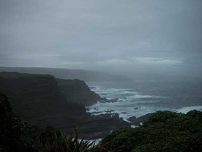
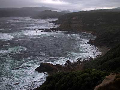
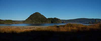
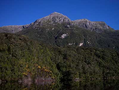
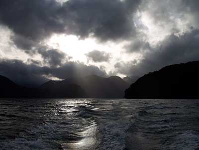
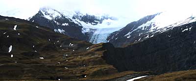
The Cascade Saddle is actually the low point on the middle to top right of this photo. The original route way back in the days of my boyhood was called the "Ernie Smith route" if I recall correctly, and it was replaced by improving on what was to be a new evolving [safer?] route known as the "Cullers Route" which exited higher up at or near where I took this photo at "the Pylon". The current incarnation and improvements of that line descends from this point to the Cascade Stream [or river - take your pick], and then ascends again to the Cascade Saddle. Yes, lots of ups and downs, but an infinitely more straightforward route on relatively easier ground [as long as it's not wet]...
cascade400-0.jpg

All week I have been pondering the sad fact that far too many people have died or come to grief in this "hard country", which can be so delightful on a good day, yet diabolical in any other sort of conditions, especially those featuring rain, wind or snow.

I don't recall the exact date as again it would have been when I was a youngster, but a person went missing in the bluffs back then, and a Royal New Zealand Air Force pilot by the name of Christopher Johnson was called on to search, and he did in a Harvard fighter plane, but unfortunately crashed and perished in the lower Cascade Stream, and so the initial tragedy was compounded! He has had a glacier named after him, but this is a sad "2nd best" to a life lost in the prime...

Of course I never knew Christopher, but I was to get to know people who knew and loved him, and I often have reflected how life would have worked out differently for many had he not perished at such a young age. On another level at the time of this tragic event he'd already had quite an influence on the climbing scene of the day in the NZ Alpine Club, where my outdoor skills were nurtured by those who knew him too. We live in a funny world of connectedness!

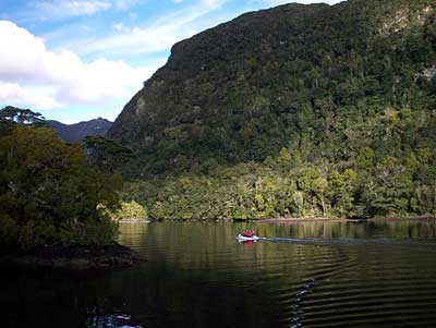
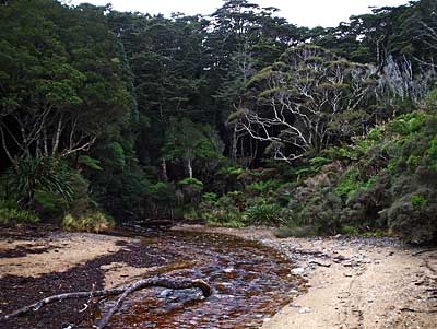
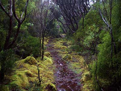
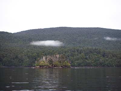
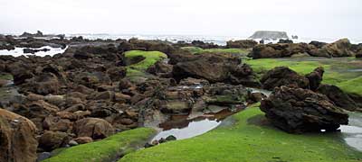
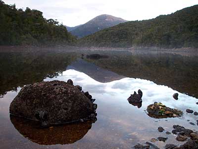
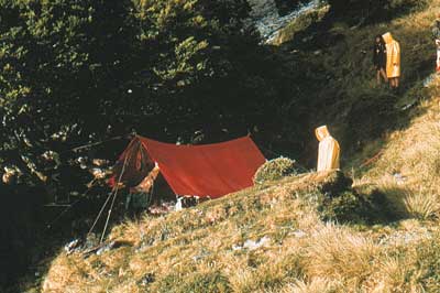
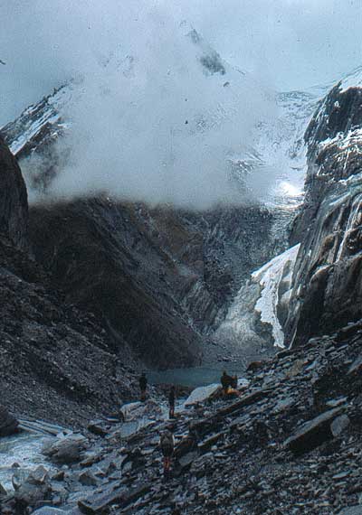
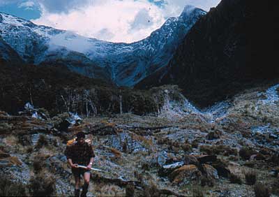
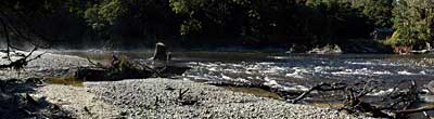
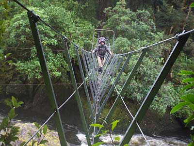
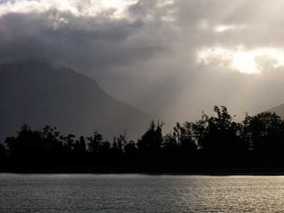
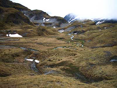
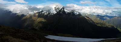
A sample of the terrain we searched between the Cascade Saddle and the Pylon...
cascade400-3.jpg

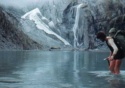
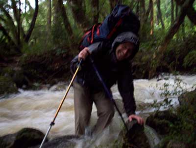
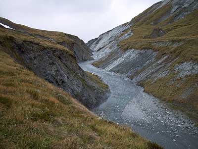
Cascade Stream [which has to be crossed - and shelter is a scant commodity if you cannot] drops maybe 500 meters vertically where it goes out of sight in this photo. A drop so awesome it's totally beyond capture on camera, however there is a taste of it about five photos down...
cascade400-4.jpg

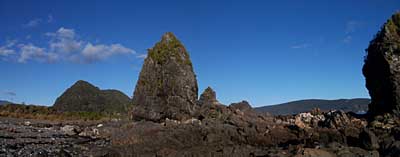
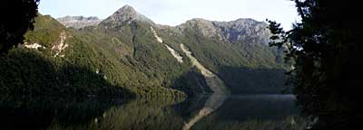
Plunket Dome, despite the easy accessibility from the Saddle it's not frequented often - maybe it's the cumulative distance...
cascade400-5.jpg

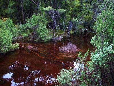
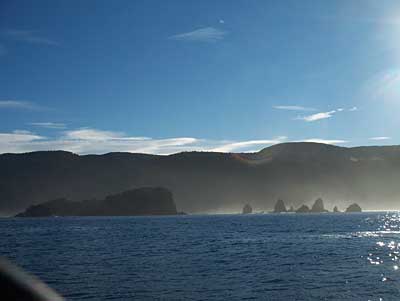
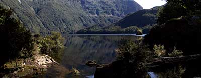
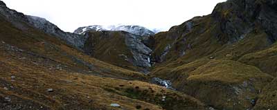
Upstream view of some of "our task" to poke our noses into: up Cascade Stream - some wild country and big...
cascade400-6.jpg

The last time I was on a Search and Rescue mission on the Cascade Saddle route back in about the late 1980s, was when we were responding to the fact that early one morning a young student had run down to Aspiring Hut and raised the alarm. His companion had slipped on snow the evening before and slid head-first into some rocks just above bush-line sustaining head injuries. He'd got her [unconscious] onto safe flat ground somehow, then erected their tent, and he'd looked after her all night essentially ensuring a clear airway in a situation where he could not sleep. Our pick-up was far from simple as we had to carry her across the same 30 degree ice/snow she'd slipped on. The Jet Ranger, which at least was "shut-down" on an area the size of it's skids precisely on the very edge of a vertical drop-off into the bluffs, was a welcome sight on our return! I'm glad it was not windy, and it could park up, 'cause it could well have been!


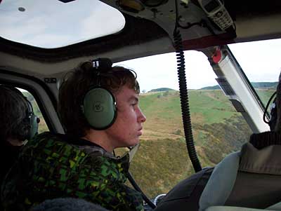
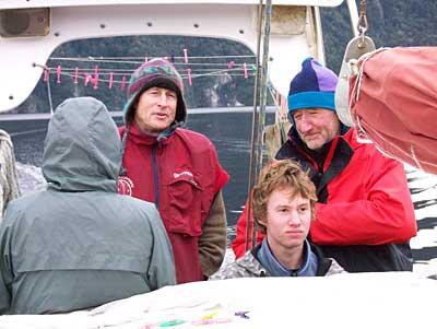
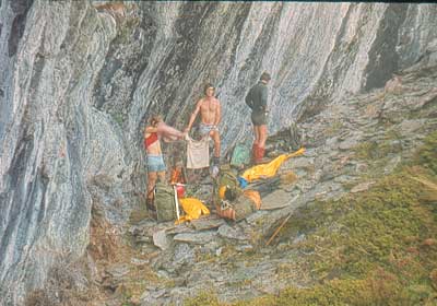
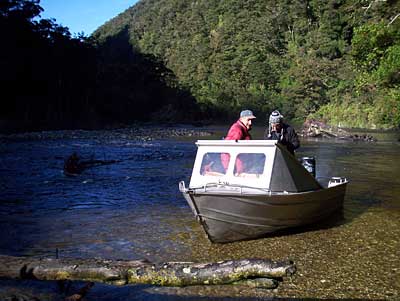
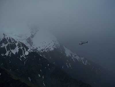
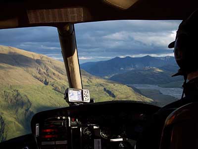
Our helicopter heading into the Dart Glacier to pick up one of our group - we had to wait quite sometime for our pickup and we discussed anything but what we'd have to do if it could not make it back before more cloud drifted in and night became a reality, not just a promise...
cascade400-7.jpg

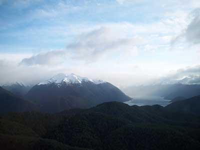
The Dart Glacier again - on the right is the drop off for Cascade Stream as mentioned earlier...
cascade400-8.jpg

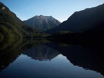
Mt Rob Roy, second only in height in the area to Mt Aspiring which is hiding on the left...
cascade400-9.jpg

Plunket Dome as the sun sets...
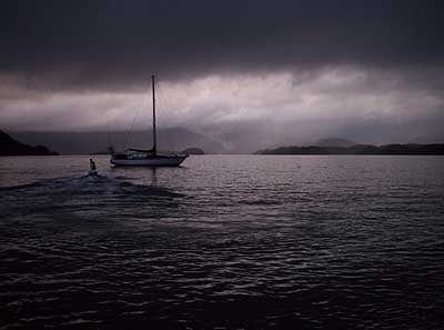
cascade400-10.jpg

I've only touched on three tragedies on this route, but there have been countless others despite education attempts and warnings. In fact at least 3 people, with significant local knowledge advised Irina to not attempt the crossing in heavy rain - especially not alone. Regularly there is a theme of disregard for conditions accompanied by a goal deemed to be pressing! Search and Rescue personal do their best in what are all-to-often "fine" [in every sense of the word] scenarios heightened by short weather windows, for time is of the essence!

Experience and respect for weather and terrain with good team work and decision making is essential and I'm posting this blog to bring these concepts onto the radar of all those who browse the web for information, while planning to enjoy our amazing New Zealand mountains and landscapes!

The comments of Marg, one of my blog readers says it nicely:

"It is a grim reality that no matter how awe inspiring , beautiful and breathtaking the mountains are we would be fools to ever call them friends or expect the elements to deal kindly to us just because we expect it to be so. I am so dreadfully sorry that these beautiful photos are inspired by a search and rescue operation. It makes the sights all the more staggering and also more reverent I suppose if that is the right word."


Some points for people to keep in mind when planning some tramping in New Zealand:

1] The terrain in geological terms and weather is far more dynamic than most realise - even those with experience in other countries fail to grasp this! History repeatedly reinforces this in the minds of us Kiwis dedicated to education and Search and Rescue [as far as I'm concerned the latter is in the "ambulance at the bottom of the cliff" catagory - it's better we're all on the top!]

2] Just because high profile [irresponsible?] travel guides tout gems of trips to promote readership, don't believe what you read. Seek local advice! The Dept of Conservation and New Zealand Mountain Safety Council are great resources.

3] Make sure all experiences a small ones, and thus survivable. The big ones don't enhance learning [maybe in the next life]!

4] All actions, or in-actions in life have consequences. If we're traveling alone in New Zealand mountains expect those consequences to be dramatic if we're not mentally prepared and "trained up".

5] Be very aware of our capabilities, and the potential for good and bad times on New Zealand walks. I've seen too many in our hills with one foot on a banana skin and the other one in the grave! The sad thing to observe is that there is often no self perception of the lack of knowledge and experience.

6] In retrospect many of us have been "saved" by bad weather. By this I mean we have all had ill conceived ideas, but never had the chance to try them because the weather intervened!

7] Leave a record of intentions [I find the written word to be best]. This is called "signing in", so be it with the Dept of Conservation or a friend or whomever, don't forget to sign out! If I'm doing a solo trip I plan it well and make the plan part of the intentions. On the trip I always do my best to stick to this plan [which often will incorporate a backup or retreat option], so that if anything happens I've left the best clues possible behind. I'd also leave messages en-route, and if things were getting tough I'd leave even more e.g. an arrow made of stones or sticks incorporating my name.


Wanaka bound...
cascade400-12.jpg

This was another memorable mountain day in the New Zealand Southern Alps, but I would have much rather have had a different reason to be in this area once again! A nice quiet trip in light airs and sunshine with my son, with lots of rests, light fluffy clouds and good cheer, with time to indulge in some serious landscape photography would be my pick for a perfect crossing!


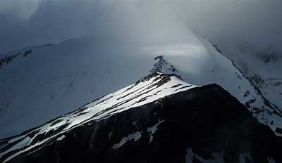
Sharks Tooth from the air...
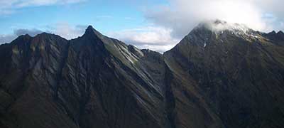
cascade400-11.jpg

Labels: , , , , , , , , ,

Monday, July 28, 2008

Preservation Inlet inc. Puysegur Point - Fiordland National Park New Zealand

My son Dougal and myself recently had an expedition holiday with friends Arthur and Barbara on board their yacht Elwing down in Fiordland National Park, one of the last of the great wilderness areas in the world in a temperate climate.

Rather than telling the tale chronologically I've created a few headings, which give a better idea of the flavour of this enchanting place.

Flying in and out

We started our trip in Tuatapere in rural Southland by staying in our camper truck at Clifden, where we awoke to this pretty sunrise...
flying1.jpg

Arthur and Barbara sailed from Stewart Island and we flew into meet them on Kisbee Beach in Preservation Inlet - here is Dougal in the front seat of the Squirrel helicopter...
flying2.jpg

It was a very long flight over one of the largest tracts of total wilderness in the country, and into a headwind with lots of turbulence. It was very interesting though e.g. Lake Hauroko is very large, "S" shaped and 40 Kms long, and the deepest lake in New Zealand, but it is hard to see it's extent from the road or tramping, so this view was fascinating...
flying4.jpg

Kisbee beach where we boarded [and departed] Arthur and Barbara's yacht Elwing...
flying7.jpg

The flight out was done via a landing at Coal Island [the latest pest eradication/conservation project in the area], in the midst of a cold front, accompanied by low cloud and heavy rain, and so we had to contour New Zealand's remote and wild southern coast line on the way out so the pilot had an horizon. The weather was much worse than this shot of same taken a few days earlier from Puysegur Point lighthouse...
flying9.jpg

Elwing

Our home - 46 foot and 20 tons worth of beautiful ship Elwing [Tolkien: Lord of the Rings princess named after the spray of a waterfall glistening in the moonlight]...elwing2.jpg

A couple of inflatable boats are invaluable on expedition holidays, and here we're going back to Elwing on one of them, from the Oil Shed [so named as storage building for oil to keep the light house light going in the old days] near Puysegur Point. The gap in the reef ahead was blasted many years ago just for this reason, but it's still a tricky passage conditional on tides and swells...
elwing3.jpg

Arthur [Skipper] gives the helm instructions while choosing an anchorage for the night...
elwing5.jpg

Lunch, and cuppas are usually served often on this white cabin top in the foreground...
elwing6.jpg

A magical anchorage by Spit Island...
elwing9.jpg

Some of my best friends and son Dougal...
elwing10.jpg

With twin keels and therefore only needing as little as 1.5 meters of water, here we take advantage of the Elwing's design to get in close to take on fresh water...
elwing12.jpg

When we went in close to this bluff, just for the fun of it, we were to find it was twice the height of our mast. The scale of Fiordland seems typified by this shot, as it looked "pint size" from this vantage point...
elwing13.jpg

Last Cove - another magical anchorage...
elwing15.jpg

Dougal at the helm and Darrell looking on...
elwing16.jpg

At every anchorage Arthur spends some time making us secure and thus safe, because this a wild land that takes no prisoners. Here he is sorting out some old mooring lines installed by fisherman back in the busy cray fishing days...
elwing17.jpg

Relatively ancient history

Before this trip I simply had no idea of the legacy of this land, and that thousands of people lived in the town of Cromarty on the again pristine Kisbee beach, around the turn of the 20th century. Earlier you saw Kisbee beach shots, and I found this fascinating photo in a Hall-Jones book on the area...
history1.jpg

The same site in the present day...
history2.jpg

More contrast...
history3.jpg

There's an old rhododendron [on above site] covering a quarter acre. It must be amazing when in flower...
history4.jpg

An old gold mining sledge track high up in the misty hills behind and south of Kisbee/Cromarty, near the Morning Star mine [shaft] leading to and from the Alpha stamping battery further south...
history7.jpg

Bogs, water and difficulties abounded on any historic track or line that we followed...
history8.jpg

The Wilson tram line to Kisbee - it's 3-4 Kms was nice to encounter as previously we'd doing steady and wet bush bashing on an old historic route down from the Alpha battery...
history9.jpg

An old sawmill boiler where the Wilson tramline meets Kisbee beach...
history10.jpg

The 1920's [restored] cemetery by the Oil Shed near Puysegur Point, with the poignant grave of a baby on the left, ...
history11.jpg

Puysegur Point light house [now decommissioned]. In it's day three families lived on-site along with a few sheep, and chickens - the later reputedly were often blown away. I did see some fresh pig sign nearby, which surprised me...
history14.jpg

The Puysergur Point light house Oil Shed in Preservation 3-4 Kms from the light house...
history15.jpg

Cuttle Cove and One Tree Island, site of New Zealand's first whaling station. The island was used as a spotting base...
history17.jpg

Spit Island notable not only for it's beauty, but also for the unassailable Maori Pa that was sited on the island's flat top, which was the site of some interesting battles three hundred years ago - a very rich story that ties in with Capt. Cook meeting a Maori family on Indian Island in Dusky Sound in 1773...
history18.jpg

Caves used not only by Maori on Step-To Island, but later by early sealers, as homes and places to build canoes and boats. Maybe favoured because the prevailing winds would blow into their dry interiors, thus ensuring less harassment from sandflies...
history20.jpg

The Tarawera Smelter reclining chimney, abandoned in the early 20th century after attempts to refine not only gold on site but other minerals such as copper. An amazing example of the skill of brick layers...
history21.jpg
history22.jpg

More recent history

Kisbee Lodge built in the seventies, and now a private sort of holiday home, with permanent caretakers, a surreal anomaly in this regenerated beach front landscape...
NewHistory1.jpg

In the later half of the 20th century over a hundred fishing boats plied this coast, now it's down to a doz. or so, and here is one of them just having uplifted all the cray pots [on the rear deck] for placement somewhere else...
NewHistory2.jpg

Wildlife

I was really hoping to see some calving Southern Right Whales, but was not so lucky. Also being winter the bird life was quiet, but I did see a few things...

Primal waterways...
wildlife1.jpg
wildlife3.jpg

A surprising number of Paradise Ducks...
wildlife4.jpg

Mollyhawk...
wildlife5.jpg

Jock Stewart, apparently in ill health - we did try putting him in deep water, but he persisted in posing for this shot...
wildlife6.jpg

Seals accompanied us - they seem to love just lolling about in the sea being cute and uncaring about us...
wildlife7.jpg

Shags were everywhere, but due to isolation totally at ease with humans setting anchors and pottering as they fished under our noses...
wildlife8.jpg

My friends on the voyage

People1.jpg
People2.jpg
People3.jpg
People7.jpg

And lastly the best beach landscapes I've ever seen in New Zealand - a landscape photographer's art heaven and something I did not expect to find in Fiordland

beach2.jpg
beach4.jpg
beach6.jpg
beach7.jpg
beach8.jpg
beach9.jpg
sealersBeach400.jpg

Thanks Arthur and Barbara for making it possible.


Sunday, April 20, 2008

A love affair with Mt Hooker in South Westland

Finished this at last - new pics lower down.

Mt Hooker is another of those mountains sort of in the middle of no-where and thus can be seen from everywhere! Many of us decided in 1973 that we had to stand on it's summit! These shots were my first acquaintance with this beguiling area. Since they were taken I've spent about 80 days trying to achieve that goal over many years. OK I made it so close twice, but in storms. Sitting and waiting for a clearance to not only see the entry to the last gully to the top, but also simply wanting to see the view when I got there.

Anyway this trip was a 10 day affair - we at least got a peek at the usual access ridge, but we had to pass all but a short ascent of same up, as we only had x.. amount of food. Our route was Haast river > Landsborough river > Clarke river > Marks Flat > Otoko river > Paringa river.

My trusty VW 1500 of the time bogged heading up the Landsborough river - just another effort to postpone the heavy pack until the last minute. That's Mt Hooker you can see above the car...
hooker400-1.jpg

After crossing the mighty Landsborough [all 6 of us clutching a log as we kick/floated across], we got hot and sweaty in the humid airs of the Clarke valley. Here we see my old friend Dave [now lives here in Wanaka too] demonstrating his diving skills - boots and all...
hooker400-2.jpg

While following a lovely trail left beside the first gorge in the Clarke [don't worry - there were about 4 more really gnarly gorges!] by a resident meat hunter [deer] we found a canoe he obviously used to cross the river with his victims. It had blood in it, but we could not resist a paddle and swim in this magical place...
hooker400-3.jpg

We knew we might have to retreat from Marks Flat back down the Clarke. In this high rainfall area, crossing side streams can simply stop all in their tracks. On one we knew could be troublesome, we found a cable, so here we practiced how to cross same. We did work out a technique, but thankfully it never came to that...
hooker400-4.jpg

It took a few hards days to get to one of the most beautiful camp sites I've ever known - Murdoch Creek on the slopes of Mt Hooker. The perfect staging post for a summit attempt that was not to be...
hooker400-5.jpg

None of us actually worked for the Ministry of Works, but for South Westland we loved the impervious yellow PVC parkas - perfect for the copious rain here where any tendency to sweat never comes close to how wet you can get if you have a poor parka. That's myself on the left, then [now sadly the late] Chris, and Bruce [who went on to became one of NZ's most active conservationists]...
hooker400-6.jpg

Under the red fly is a four person tent - there were six of us, so keeping warm in the light snow that was about to fall the evening of this shot was no problem...
hooker2-400-1.jpg

Sunset light through beech forest...
hooker2-400-2.jpg

Some new snow in the background adds another dimension to this awesome bivouac spot. Every morning at precisely 6 am we'd been woken by a Kea visiting us briefly - in my growing education re. this incredibly intelligent native New Zealand mountain parrot I was to realise, starting at this point in time, that they have a very accurate sense of timing...
hooker2-400-3.jpg

It was time to be on our way or we'd run out of food, so we climbed up for maybe an hour above the camp with all our swag, and stopped briefly to admire the route above we had designs on, but not this time [I was to return later with others to camp up there and climb]. After a bite to eat and many photos we headed down to the right to Marks Flat...
hooker2-400-4.jpg

Marks Flat with the legendary Kea Cliffs on the right. OK we missed out on a climb of Mt Hooker, but part of our dreams incorporated exploring and wandering around in this unique cirque-like landscape. It turned out to be quite boggy, but we still enjoyed a night down there all cosy under a rock, before heading around to the left to Lower Otoko pass the following day...
hooker2-400-5.jpg

After a straight forward descent to Marks Flat we found the desired small bivy rock to sleep underneath of, but I was more captivated by these rare blue ducks in the nearby stream than I was about the extremely low roof...
otoko1.jpg

The next morning it was raining, but hunger is a great motivator and we toddled off across Marks Flat [actually almost swamp like in places] to cross Lower Otoko pass - our route to the West Coast.

It was an honest climb up from the Flat with waist deep snow grass to wet us from the bottom as well as the rain coming down steadily - travel about as miserable as it can get! However I achieved my desired Zen like state of being "in the zone" and next I recall the misery escalating as we started wrestling with the next challenge: chest high alpine scrub. This medium is not an easy vegetation mode to gain height on... you sort of stand half in it bereft of any solid footing, grab the next armful of springy tenacious and dripping wet foliage and heave upwards, to the next wobbly stance, where oxygen is sucked in.

It was getting about as awful as it could when a cheerful Noddy [Michael N - now sadly "the late" and ex Kurow] yelled out to me from above "hurry up Donald, we've got a fire going". I would have sworn at what could have been a cruel joke, but never having been one for wasting words going uphill, and somehow thinking "something unusual is happening up there", I pulled over the last bush and lo... there was a huge overhanging bluff on the left, complete with a generous firewood supply. Chris, Dave and Noddy did indeed having a cheerful fire going, setup to reflect the welcome heat off the rock. A brew was soon on and here we see Chris drying his shirt...

otoko2.jpg

Crossing Lower Otoko pass the weather improved a bit, but we did not linger - we were wet but drying, and also mindful of the unknown descent. We knew it'd been done before, but as you can see in the photo below the pass [and just above difficulties] the terrain is very dynamic, highly mobile and glacial lakes like the one here are even more so. We had not a clue how we were going to cross it, as we knew bluffs would force us to do so...
otoko3.jpg

Here Ken crosses the first of the couple of lakes cautiously and is oblivious to being distracted by the taking of this by the author, who was endeavoring to get an embarrassing/funny shot, but he refused to stand upright...
otoko4.jpg

Close scrutiny of this shot will reveal one of many cunning techniques often employed in South Westland to keep clothes dry [well not totally as dampness pervades - and polypro had not been invented yet - we were merino wool and bushshirt kids] Today we'd be called organic... [as I compose this blog I wonder how I got so elevated to take this shot... I've never been able to levitate this high even to get above ice cold glacier water!]...
otoko5.jpg

The author in his early days [has his hair always been silver and here it's been rinsed?] He does seem to have that middle distance stare even at such an early age - a sure sign of too much time of a reflective nature in the bush, focusing on sandflies, and being lost...
otoko6.jpg

The going gets easier over an area cleared of vegetation by a winter avalanche. The night's camping spot is close...
otoko7.jpg

The night however was not an easy one as we had several inches of rain, and the river raged beside us. I recall a heavy mist coming through the tent fly, and rolling up my sleeping bag to keep it dry and sleeping in my parka. We had a good tea before turning in though - it was Dave's birthday and we made fancy instant puddings with dried milk and decorated them with jelly beans. Unfortunately Ken had lost his veteran kea nibbled bowl porridge bowl, but we managed somehow. It may have fell victim to the nearby river.

There don't seem to any other shots I've scanned - nothing stellar anyway as for the next two days we travelled in heavy bush and fern, only getting relief when crossing precipitous ravines on tree trunks felled across them by the local meat shooter, whom we never met as we travelled down the Otoko and then down the Paringa to the West Coast Road. Here we witnessed a "heavy dude" on a motorbike fail to take the corner to the bridge and end up uninjured in a gnarly patch of black-berries, just close by where we had a car depot'd to get us back down to the Haast. A rude entry back into so-called civilisation!

Sunday, April 6, 2008

Seeking primordial swamps and puddles in Fiordland National Park, New Zealand

I joined my friend Roger for a few days off to seek definitive photographs of the primordial sort in New Zealand's very remote and wild Fiordland National Park. Art was the objective. I feel so privileged as I compose this blog as it reminds me yet again [2 days after completion] of how such a journey is where we can learn from being tested as nature imposes it's rules and time-tables, thereby challenging us to be gentle in the soul and mindful of how to best live our lives...

Our entry point to this remote land was the Middle Fiord of Lake Te Anau - here we see it in the distance to the right, from Te Anau Downs at dawn...
hank400-1.jpg

Our boatman Vern, a living legend in Fiordland with a wealth of information gleaned from a lifetime's professional hunting with an accompanying acute observation of nature...
hank400-2.jpg

At the head of the Middle Fiord we walked to another lake where we transitioned to another of Vern's boats [heli'd in several yrs. ago] to take us further west...
hank400-3.jpg

The left ridge on this mountain was one of our potential goals - we did get to the bottom of it, but not up it, but then, being Fiordland, the next front was upon us the next day with accompanying rain...
hank400-4.jpg

The views boating were stunning, despite the bite of old man frost...
hank400-5.jpg

It was sobering to consider just how remote we were going, when you need so many resources to just get in and out to the start of the foot work! This was as far as we could go with Vern's help , so we said our good-byes, asked him to pick us up on Friday, Roger stepped ashore, and we pushed him off into the current...
hank400-6.jpg

We then headed up this river bed into the frost smoke. Note the hut on the right in the shade - one we would be so happy to warm up in on our very wet and cold return journey...
hank400-7.jpg

hank400-8.jpg

Yet another lake, but no boat on this one! After crossing the outlet seen here, on a nearby 3 wire bridge we then tackled the rather rugged marked route which was to take us around to the area seen here a bit on the right of center...
hank400-8a.jpg

Into the primordial stuff...
hank400-9.jpg

We had a couple of days in a hut with Roger doing some solo exploring and myself enjoying a day off from life snoozing, as the rain pattered about. But all good things come to an end, and we headed off early on Friday to retrace our steps in quite a storm - about a 7 out of 10 on the Fiordland scale, with periods of approx. 1 inch of rain per hour falling. In this sort of rain even kit inside plastic bags gets wet, and we were to witness sheets of water hitting the lake surfaces and then bouncing up again - something I've seen before, but it's still a marvel! This shot shows the waterfalls starting to leap into action, with a nice primordial swamp foreground...
hank400-10.jpg

Rain or no rain, Roger had one shot left, so out came the "third member" [tripod], the big Technorama pano film camera and I held a hat over proceedings...
hank400-11.jpg

The trip out was technical - this is not disneyland in the rain, but Fiordland in it's enchanting natural uncompromising state that simply forces respect and humility and lays a flavour of fragility over one's self...
hank400-12.jpg

Roger on one of the 3 wire bridges - once mastered their consistency of footing is a welcome change from accompanying courses of green boulders, slippery tree roots and branches [yes, you're often well off the ground in this terrain, be it on bridges or on land]...
hank400-13.jpg

There is always on-going attrition in the rain-forest - the trick is to not be under a tree going down...
hank400-14.jpg

Not far from meeting Vern - the rain is easing, the bush enchanting, with the shades of green defying description in their luminosity...
hank400-15.jpg

The last hut out before the boat, and just as you'd expect from a considerate and gentle seasoned campaigner in the hills, Vern was in there with a couple of Wapati hunters who'd come down from the tops before the storm, and they had a brew on the fire ready for us soaked rats, and the hut all nice and cosy...
hank400-16.jpg

Back on a Lake Te Anau after our first boat trip in the wee local boat, and now into the larger one for a bumpy trip home...
hank400-17.jpg

Looking back...
hank400-18.jpg

hank400-19.jpg

Labels: , , , , ,

Sunday, February 17, 2008

A photo blast from the past

Out of an archeological dig into my memoirs here are a few from the sixties and seventies in the Southern Alps.

A tough fly camp in Canyon Creek Ahuriri valley...
fly_snow.jpg

That's me on the left, in the sadly deteriorated photo below: 1967 on my first really serious trip at Easter in the Hopkins valley [Lake Ohau]. We crossed a high pass to prove it linked with the south branch of the Elcho valley. In short a mapping exercise into the very much "unknown". My mentors looked after me well though on the steep ice/snow with crampons, rock and nasty bluffs with steep snowgrass... we got stormed on... thunder/lightning...wet sleeping bags, living under boulders, lots of laughing. It was the perfect introduction to NZ's middle sized mountains and weather!
EasterPass67.jpg

A brave driver getting his "now classic" Land Rover to Elcho Hut. Upper Hopkins valley in the background...
elchoLRover.jpg

A year or two later at a hut working "bee' at Elcho hut we burnt the old mattresses. Dasler Pinnacles in the background...
mattressfire.jpg

By the cattle yards in the Ahuriri valley. Yes, eagle eye motoring enthusiasts that is a Skoda based NZ Trekka there. Now that was quite a vehicle... totally weird, but I wish I'd kept it! That's my mum beside it. Loving mountains as I did I'd occasionally talk them into coming for a wee drive. My mum loved it, but my dad sort of suffered it. He'd been in them all his life and for some reason his sense of adventure had eroded - probably the war. Anyway...
yards.jpg

Thursday, January 3, 2008

The passing of a friend and some retro photos

I'd like to note the passing of a friend and fellow cross country skier Anton Wopereis a few days ago on Mt Cook.

We went back a long way to a time when we were doing big trips back-to-back, and we'd always tend to cross paths coming and going from huts, or noting in hut books that we were there just days or hours apart. It was subsequently a joy to me that we ended up living in the same town, and hanging out x/c skiing together. Everything good that was said about him in the numerous press releases was so true.

As a reminder of those old days and since it is a new year, here are some early photos [scanned] of trips I did in that other age:

Alistair on Mt Hooker...
retro400-1.jpg

Myself on Glenmary [Mt Hooker is the pointy peak in the back ground and we'd just spent 10 days trying to climb it, but weather beat us, so we were pretty fit on this Glenmary day - a peak closer to home in the Lake Ohau area]...
retro400-2.jpg

Julie on the Quarter Deck on the approach to Mt Aspiring...
retro400-3.jpg

Some really early stuff: That's me on the left with the [late] Michael Nother and David McNulty. Mike lived too close to the edge in life and finally succumbed some years later, and then later again David got buried in an avalanche while guiding and never made it out. We're enjoying a fly camp here in Canyon Crk. in the Ahuriri - that's a radio aerial across the photo...
retro400-4.jpg

The above Canyon Crk. trip turned into a really tough one weather wise. That's me in the background in my new swani [which leaked and weighed a ton as I recall], and David again. We're looking serious as we're about to go up for a couple of very hard nights living under a tent fly in wind and snow storms. I think we were pretty silly in one way, but we learnt a lot in this style of experiencing small mountains in bad conditions. We were taught to always ensure all our experiences were small ones and thus survivable!
retro400-5.jpg